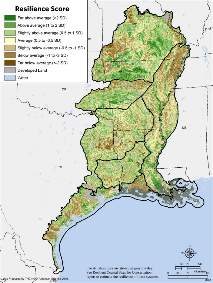
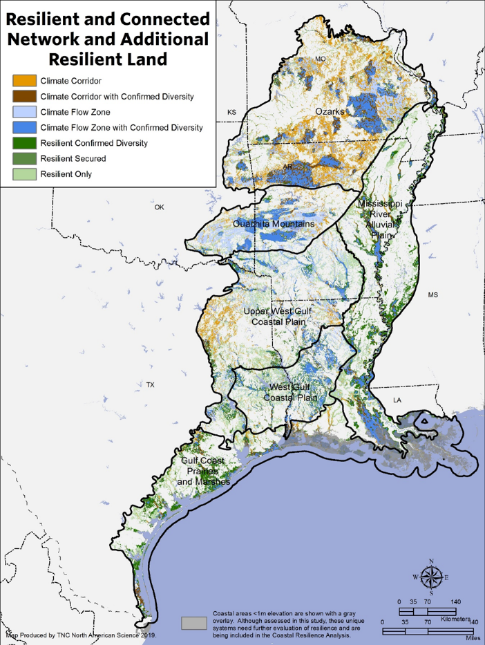
This analysis identifies a network of climate resilient sites and connecting corridors across the Ozark and Ouachita Mountains, the West Gulf Coastal Plain, Gulf Coast Prairies and Marshes, and the Mississippi River Alluvial Plain.
Open the report describing our analysis.
Click
here to go to the page of the
rolled up Resilient and Connected analyses for all regions.Here is a direct link to the data page for the all region roll up.