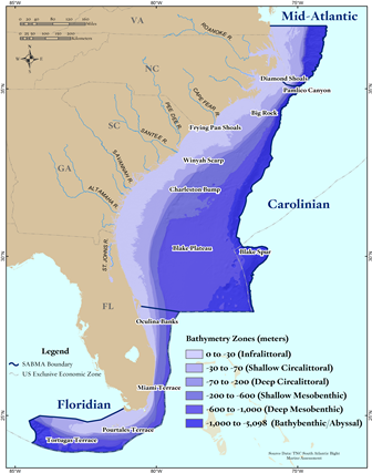
Healthy coastal and marine habitats are vital to both people and natural communities. New and increasing activities in nearshore waters are increasing the need for spatial resource and use information to aid in decision-making. The South Atlantic Bight Marine Assessment (SABMA) builds on decades of marine research and data collection to improve understanding of critical habitats and their relationship with key species and oceanographic properties.

The breadth of the assessment is large and required significant partner collaboration. Covering over half of the Atlantic seaboard from the mouth of the Chesapeake Bay to the Florida Keys (over 17,000 miles of coastline & 93 million acres), the project areas extends inland from the area of tidal influence seaward beyond the shallow continental shelf to the base of the U.S. portion of the continental slope. Over 30 technical experts from across the region engaged in review of the assessment to ensure validity of all products.
The result is regional baseline spatial data on the distribution and status of seafloor habitats, coastal systems, marine mammals and sea turtles. Evaluation across resources enabled the identification of a conservation portfolio – areas of ecological importance. These products, when combined with ocean use and more localized resource data, contribute to the body of knowledge needed to help reduce potential conflicts between and among human uses and ecologically significant resources.
Financial support was provided by:
Go directly to the final South Atlantic Bight Marine Assessment report
here.
