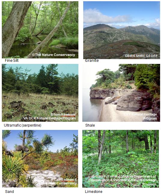
The Nature Conservancy’s Northeast Resilience Project identified places that will be more resilient to climate change and serve as natural strongholds for diversity into the future. To locate and map resilient places, the science team examined 29 different physical environments, such as granite mountains, limestone valleys, and sandplains. Within each environment, they found land where the direct effects of climate change are moderated by complex topography, dense wetlands, and permeable natural cover. They compared these climate-resilient places with places known for their high quality biodiversity to pinpoint lasting strongholds for diversity. The project was guided by a steering committee of internal and external scientists, and the results are being used to add a climate change filter to The Conservancy’s land protection projects. Funding was provided by the Northeast Association of Fish and Wildlife Agencies, the Doris Duke Charitable Foundation, and The Nature Conservancy.
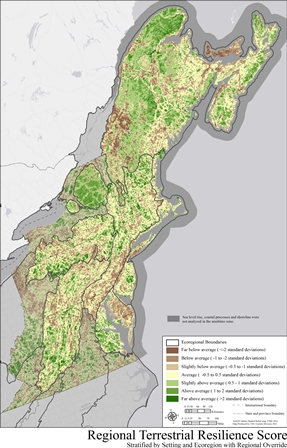
In the Northeast, sites were compared with other sites of the same physical environment based on their geology, elevation zone, and ecoregion, technically their “geophysical setting”.
Examples of the same geophysical setting were evaluated for two characteristics. The first, landscape diversity, refers to the number of microhabitats and climatic gradients available within a given area. Landscape diversity is measured by counting the variety of landforms, the elevation range, and the wetland density. Because topographic diversity buffers against climatic effects, the persistence of most species within a given area increases in landscapes with a wide variety of microclimates. Local connectedness, the second factor, is defined as the number of barriers and the degree of fragmentation within a landscape. A highly permeable landscape promotes resilience by facilitating range shifts and the reorganization of communities.
The map shows areas in the northeast predicted to be more resilient to climate change (green), or more vulnerable to climate change (brown), with respect their type of physical environment. Coastal areas (in gray) need further assessment due to sea level rise. Click map to enlarge.
The study area includes 13 states (ME, NH, VT, MA, RI, CT, NY, PA, NJ, DE, MD, VA, and WV) and Maritime Canada (NS, NB, PE, and parts of QC). This report is a counterpart to Resilient Sites for Terrestrial Conservation in the Southeast.
This report is a counterpart to
Resilient Sites for Terrestrial Conservation in the Southeast Region.
