The tidal creek macrogroup consists of the following aquatic habitat types:
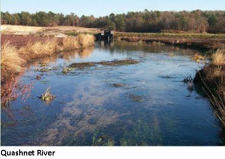
Tidal Headwaters and Creeks
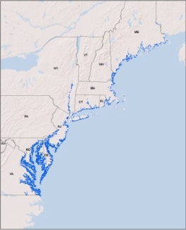
Distribution:
CT, DE, DC, ME, MD, MA, NH, NJ, NY, PA, RI, VA. 7,835 miles of habitat in the region, of which 13.2% of the 100m riparian buffer is conserved.
Description:
Slow-moving, shallow, tidally influenced creeks and headwater streams. These tidal creeks and streams connect directly to the ocean or to large tidal rivers estuaries and have watersheds under 39 square miles. The water flow and level in these streams fluctuates with the tides creating subtidal habitat which is permanently flooded and an intertidal habitat exposed at low tide. Salinity typically ranges between 30 and 0.5 ppt and grades into a freshwater system in the upper portions of many of these reaches. Most tidal streams have moderately firm, sandy channel bottoms and vertical banks that are regularly eroded and slump into the creek bottom. Many have a very sinuous pattern as they wind through large salt marshes along the coast. Others have smaller associated brackish or salt marshes along their length and/or intertidal sand and mud flats in their lower portions. These streams and their associated estuaries support a rich diversity of plant and animals and serve as the primary nursery area for many marine fishes. The ecological importance of small tidal streams has historically been undervalued, but recent research is showing their collective influence on estuarine ecosystem function may equal or exceed that of larger tidal rivers.
Download the
pdf for this habitat for information about species, crosswalks to state names, and condition of this habitat.
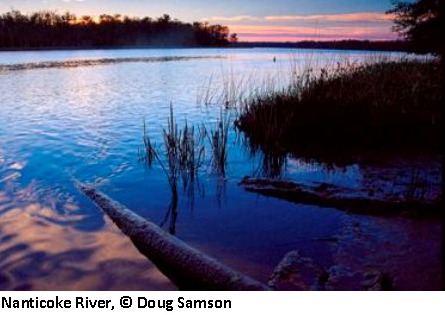
Tidal Small and Medium Rivers
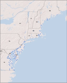
Distribution:
CT, DE, ME, MD, MA, NH, NJ, NY, PA, RI, VA, WV. 1,885 miles of habitat in the region, of which 18.2% of the 100m riparian buffer is conserved.
Description:
Slow moving, small to medium, tidally influenced rivers. These small to medium sized rivers connect directly to the ocean or to large estuaries and their water flow and level fluctuates with the tides. They drain watersheds up to 1,000 sq.mi.in size and have an average bankfull width of 89 feet. In the river there is a vertical salinity gradient, with a surface layer of fresh water (salinity less than 0.5 ppt) floating over a deeper layer of brackish water (salinity between 0.5 and 18.0ppt). Salinities at any one place in the river may fluctuate as the tides flow in and out because the "salt wedge" of brackish water alternately rises and falls with the tides. Vegetational and faunal communities found in and along the river are determined by both depth and salinity. Commonly associated communities include brackish and salt marshes, swamps, and mudflats. These rivers and their associated estuaries support a rich diversity of plant and animals and serve as the primary nursery area for many marine, estuarine, and anadromous fishes.
Download the
pdf for this habitat for information about species, crosswalks to state names, and condition of this habitat.
Tidal Large Rivers
Distribution:
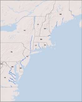
CT, DE, DC, ME, MD, MA, NJ, NY, PA, VA. 1,026 miles of habitat in the region, of which 15.9% of the 100m riparian buffer is conserved.
Description:
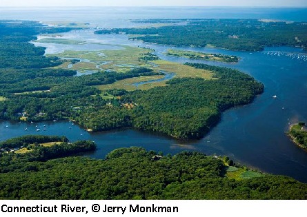
Slow moving, large, deep, tidally influenced rivers. These very large rivers connect directly to the ocean or to large estuaries and their water flow and level fluctuates with the tides. They have large upstream watersheds >1000 sq.mi and average bankfull widths of over 300 feet. In the river there is a vertical salinity gradient, with a surface layer of fresh water (salinity less than 0.5 ppt) floating over a deeper layer of brackish water (salinity between 0.5 and 18.0ppt). Salinities at any one place in the river may fluctuate as the tides flow in and out because the "salt wedge" of brackish water alternately rises and falls with the tides. Vegetational and faunal communities found in and along the river are determined by both depth and salinity. Commonly associated communities include brackish and salt marshes, swamps, and mudflats. Most of these rivers have extensive salt marshes an/or intertidal sand and mud flats at their mouths. These rivers and their associated estuaries support a rich diversity of plant and animals and serve as the primary nursery area for many marine, estuarine, and anadromous fishes.
Download the
pdf for this habitat for information about species, crosswalks to state names, and condition of this habitat.