The Cliff and Talus macrogroup consists of the following habitats:
Regional distribution:
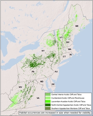
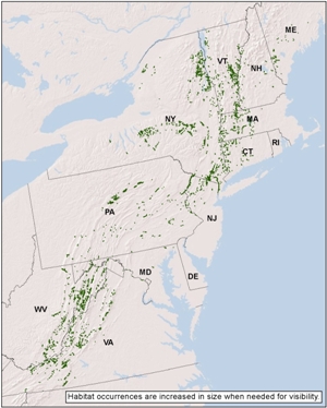
CT, DC, DE, MA, MD, ME, NH, NJ, NY, PA, RI, VA, VT, WV. 561,802 total acres of habitat, of which 48.2% is conserved.
Description:
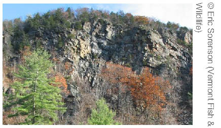
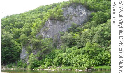
A sparsely vegetated cliff or talus slope formed on granitic, sandstone, or other acidic bedrock. The lack of soil, highly acidic bedrock, and constant erosion, limits the vegetation to mosses, lichens, and herbs growing on bare rock or crevices, and to sparse trees and shrubs rooted in deeper soil pockets. Lichen cover may be extensive. In the Central Appalachians, red-cedar trees, poison ivy vines and rock polypody ferns are characteristic. Birch or spruce replaces red cedar in the north, where a shrubland of heaths and reindeer lichen may develop where cold air accumulates at the sheltered bottom of slopes. Areas of concentrated seepage are sometimes present. In the Cumberland region, a mosaic of cavelike "rockhouses" and associated sandstone box canyons are typical.
Download the pdf for this habitat for information about species, crosswalks to state names, and condition of this habitat.
Regional distribution:
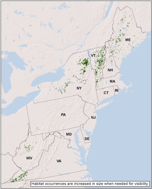
MA, ME, NH, NY, PA, VA, VT, WV. 56,251 total acres of habitat, of which 48.2% is conserved.
Description:
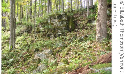
A sparsely vegetated cliff or talus slope formed on limestone, dolomite, or other calcareous bedrock. The high alkalinity (pH>7) increases nutrient availability, but the lack of soil, constant erosion, and harsh edaphic conditions limits vegetation to herbs, ferns, and sparse trees growing in rock crevices or soil pockets. Northern white cedar is characteristic and may dominate on some cliffs, somtimes reaching ages upwards of 800-1000 years. Ash and basswood and bladdernut are other woody indicators of the enriched setting, as are ferns like spleenwort and cliffbrake, and wiry herbs such as rock whiltow grass. This system includes the narrow zone of vegetation at the horizontal clifftop where growing conditions are harsh and often gladelike or grassy.
Download the pdf for this habitat for information about species, crosswalks to state names, and condition of this habitat.
Regional distribution:
CT, MA, MD, ME, NH, NJ, NY, PA, VA, VT, WV. 56,454 total acres of habitat, of which 35.7% is conserved.
Description:
A sparsely vegetated cliff or steep talus slope formed on calcareous sandstone or shale or other moderately calcareous bedrock. The vegetation varies from sparse to patchy as the lack of soil and constant erosion restricts vegetation growth to rock crevices or soil pockets. Trees are typically present and may form woodland or even forest vegetation. Basswood, ash, and bladdernut are woody indicators of the enriched setting; northern white cedar is sometimes present. The herb layer is typically not extensive but includes at least some species that are indicators of high nutrient conditions.
Download the pdf for this habitat for information about species, crosswalks to state names, and condition of this habitat.