Latest On The Conservation Gateway

A well-managed and operational Conservation Gateway is in our future! Marketing, Conservation, and Science have partnered on a plan to rebuild the Gateway into the organization’s enterprise content management system (AEM), with a planned launch of a minimal viable product in early FY26. If you’re interested in learning more about the project, reach out to megan.sheehan@tnc.org for more info!

To support the comprehensive ocean planning and ecosystem-based management approaches, high quality and high resoluation spatial data is needed. 

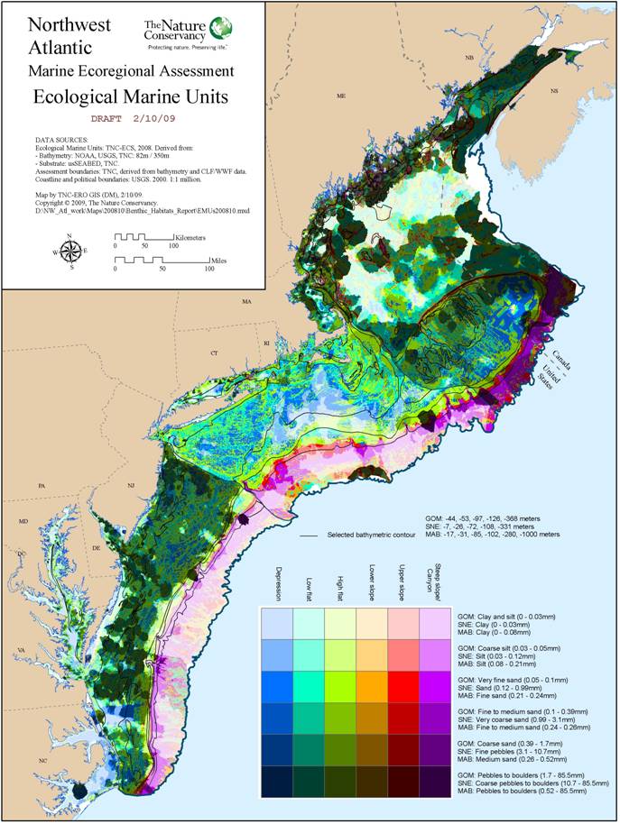
The first phase of NAM ERA compiled data on marine ecosystems, habitats and species in the Northwest Atlantic. This project synthesized diverse spatial data, designed to meet the needs of a variety of users, including supporting decisions about conservation and resource use. Over 1,200 data files, from over 100 sources, were compiled for this assessment. Every effort was made to understand, and account for, the idiosyncrasies of each dataset, and to respect the value of each source. 

Explore the maps for each chapter:

Seafloor habitats: Basic maps
Coastlines and estuaries: Basic maps
Marine fish: Basic maps
Marine mammals and turtles: Basic maps
Large pelagic fish: Basic maps
Ocean process: Basic maps
 

Download the data directly:

Chapter 2 - Coastal ecosystems -Download the data
Chapter 3 - Benthic habitats -Download the data
Chapter 4 - Physical oceanography -Download the data
Chapter 5-8 - Marine fishes -Download the data
Chapter 9 - Large pelagic fish -Download the data
Chapter 10-11 - Cetaceans and sea turtles -Download the data


 Updates

 Questions? Contact us

​Send us an email by clicking here