What is beneath the waves? Data mining from Georges Bank to the Chesapeake (SMAST)
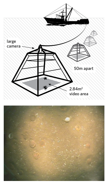 To improve our work to conserve marine resources, The Nature Conservancy wanted to know more about the Northwest Atlantic Ocean. To do this, we partnered with the University of Massachusetts, School of Marine Science and Technology (SMAST). Working with the New Bedford fishing fleet, SMAST has conducted video surveys from Georges Bank to the Chesapeake Bay for over a decade. Even though the original purpose of the video survey was to assess the abundance of sea scallops, at the end this project collected much more information. As a result, we have new maps of a dozen species (including sea stars, scallops, bryozoans and hydrozoans, sand dollars, hermit crabs, skates, sponges, red hake, moon snails, crabs, flatfishes, and burrowing species); as well as habitat types and oceanographic features throughout the survey area.
Major Project Takeaways
- Georges Bank appears to be a more dynamic ecosystem than the Mid-Atlantic with larger magnitudes of benthic stress, more areas with a higher diversity of benthic epifauna, and coarser substrate types.
- Both surface and bottom temperatures tend to be more variable along the shelf break in the Mid-Atlantic Bight.
- On Georges Bank, bottom temperatures have fluctuated more in the center of the shelf, but have remained consistent around the shelf break. In contrast, surface temperatures tend to fluctuate more across the whole of Georges Bank.
- Bottom salinities fluctuate more south of Cape Cod.
- The most variable areas of either average or maximum bottom stress are south of Nantucket and in the center of Georges Bank.
- The Great South Channel appears to be an area of high environmental variability and was most diverse in terms of observed animal groups
More Information...
Use the links on the right to download the full report, a poster with the main points. Also, click on “Spatial Data” to download the full spatial database resulting from this project.
