More than ever before, the world is looking to the ocean to provide food, energy, new medicines, recreation opportunities, and a host of other products and services. Balancing the diverse and growing uses of the ocean’s resources with long-term economic and ecological health is challenging. It requires innovative planning processes that integrate the best available natural resource and human use data in new ways.
The Coastal Georgia Recreational Use Mapping Project was designed to help fill a critical data component in ocean use planning - human use (recreation) data. Information was collected by directly engaging stakeholders and will be provided to resource managers. The result is a better understanding of recreational uses in coastal Georgia, helping inform management decisions to better protect the region’s ecosystems and improve the coastal user experience.
Project Area
Stakeholder Engagement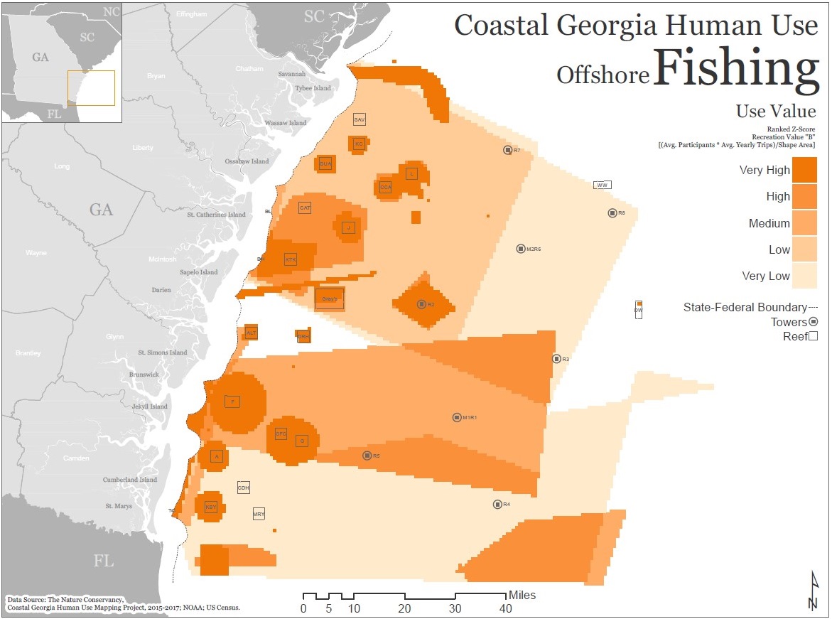
Emphasis was placed on directly engaging Georgia recreational stakeholders. We used a participatory approach (interactive workshops and surveying) to gather spatial and descriptive data on six main recreational uses (fishing, boating, birding, diving, paddling, ecotours). In addition to data collection, this provide an opportunity to involve stakeholders in discussions around the benefits and challenges of ocean planning. Over 400 recreational stakeholders participated in mapping workshops and surveying from 2015-2017. Birding data was also collected from a this secondary source -
eBird.
Project Results
Final products include a series of maps that improve understanding of where and how frequently key recreational activities occur along the Georgia coast and in offshore waters. Combining this recreational use information with natural resource data can help understand and reduce potential conflicts between and among uses and natural resources.
Click the following links for:
For questions and access to the geodatabase, contact
Bob Crimian.
