On this page we feature LANDFIRE "Snapshots" -- reports of one-to-two pages each that provide a quick summary of various applications.
Each report includes project description, objectives, methods, resource suggestions, many photos, and project contacts.
The following selection is by no means comprehensive. On the Gateway, also check the main
Applications page,
LANDFIRE Publications
(we generated them),
Publications (selected bibliography),
Videos
(LANDFIRE YouTube resources), and the
Web-Hosted Application Map (WHAM!).
Alphabetical by title
An Assessment of the Ecosystems Nantahala-Pisgah National Forest and Surrounding Lands: A Synthesis of the eCAP Methodology and lidar Vegetation Analysis
Author Josh Kelly and others compared current vegetation conditions with desired conditions in order to explore and highlight the management needs of 10 major ecosystems in a 1,700,000-acre study area of global conservation significance.
An Evaluation of the Forest Service Hazardous Fuels Treatment Program - Are We Treating Enough to Promote Resiliency or Reduce Hazard?
In an effort to mimic natural fire disturbance and mitigate potential negative wildfire impacts proactively, the Forest Service fuels program reduces wildland fuels through prescribed burning and mechanical treatments. With the development of nationally available, spatially explicit data, it was possible to evaluate the Forest Service fuel treatment program using the actual treatment footprints.
 Are investments to promote biodiversity conservation and ecosystem services aligned?
Authors investigated the degree of alignment between investing conservation funds to target biodiversity conservation and investing them to target the value of services that contribute to human well-being, e.g. ecosystem services. (Click above title for summary.
Click here for full report.
Photo by Jim Smith
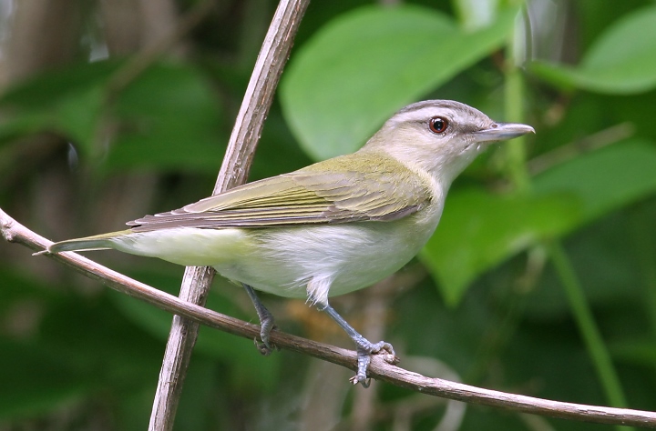
Chihuahuan Desert Grassland Bird Habitat Relationships and Abundance.
Duane Pool and others provide science-based guidance to mitigate declines in wild bird populations through habitat protection, restoration and improvement.
Collaborative Forest Landscape Restoration Program Monitoring for Shortleaf Pine in the Ouachita National Forest of Arkansas and Oklahoma.
The project goal is to restore large swaths of shortleaf pine-bluestem habitat on the Ouachita National Forest. LF2010 data and vegetation monitoring plots are being used to track changes in the community over time.
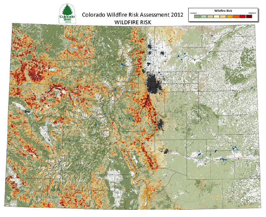
Colorado Wildfire Risk Assessment Portal (CO-WRAP)
The LANDFIRE Program Refresh 2008 version of data products were used to compile the
Surface Fuels data for the West Wildfire Risk Assessment, and the Colorado Wildfire Risk Assessment.
Determining Priority Areas for Prescribed Fire – A Case Study from Wisconsin.
The Wisconsin Fire Needs Assessment was conducted with the input of a large group of stakeholders and partners. The goal was to identify areas where successful long term management would be helped by using prescribed fire in priority areas.
Developing site-specific nutrient criteria from empirical models.
John R. Olson and Charles P. Hawkins developed Random Forest models to predict how base-flow concentrations of total P and total N vary among western USA streams in response to continuous spatial variation in nutrient sources, sinks, or other processes affecting nutrient concentrations.
Development of the Rangeland Vegetation Simulator
According to Project Director Dr. Matthew C. Reeves, the RVS was developed as a research tool enabling projections of future vegetation conditions improving our ability to estimate the effects of management actions on future vegetative states. RVS is also a decision support tool enabling land management agencies to more accurately describe post-disturbance successional dynamics, and most importantly, estimate wildland fire behavior and effects.
The goal of this work by M.C. Reeves and J.E. Mitchell was to quantify the extent of rangelands in the conterminous U.S. by developing an objective and repeatable approach to rangeland mapping. LANDFIRE 2001 EVT, EVC, EVH and BpS data, along with the LANDFIRE Reference Database, were used.
Fire Management in the National Wildlife Refuge System: A Case Study of the Charles M. Russell National Wildlife Refuge, Montana. 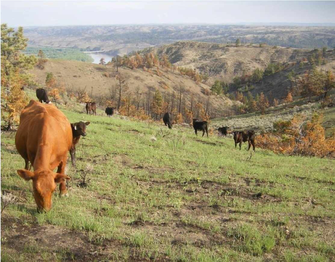
Reid and Fuhlendorf examine the fire regime of the Charles M. Russell National Wildlife Refuge over the previous 28 years and compare it to historical fire regime reconstructions.The results provide a clear picture of what has happened to this landscape since European settlement and subsequent fire exclusion.
Fire Regime Syntheses: Synergy between the Fire Effects Information System and LANDFIRE
To address managers’ needs for syntheses of the growing body of research on historical fire regimes, the Fire Modeling Institute’s Information Team developed and showcased a new product, the Fire Regime Synthesis, in the Fire Effects Information System.
GAP Analysis National Inventory of Vegetation and Land Use.
GAP mappers constructed a seamless representation of current vegetation across the continental United States and Alaska in order to create a seamless data set for the contiguous United States.
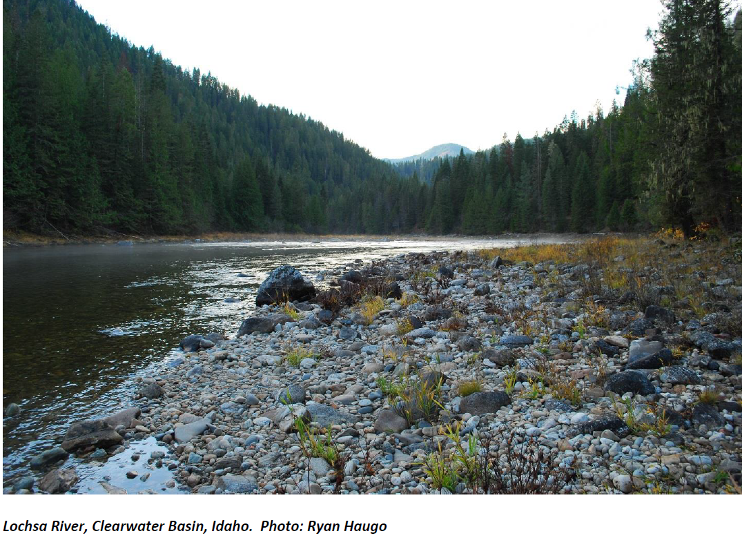 Idaho Forest Restoration Needs Assessment
Haugo and Welch evaluated landscape scale forest restoration needs. Across 20 million acres of conifer forest in Idaho, the authors found that changes in current forest structure were needed on nearly 40% of all forested acres in order to restore historic reference conditions.
Probabilistic assessment of wildfire hazard and municipal watershed exposure
Because of potential erosion, sediment redistribution, and flooding, wildfires pose a significant risk to municipal water supplies. Joe Scott and others used spatial analysis and burn probability modeling to assess the potential of wildfires in 10 Montana municipal watersheds.
Projected Effects of Climate and Development on California Wildfire Emissions through 2100.
In order to study how climate- and development-driven wildfire can impact human populations through regional air quality and pollutant levels, Hurteau et al. combined land use scenarios, population and vegetation cover models, and simulated hydrology in a spatially explicit statistical model of monthly wildfire frequency and burned area.
The relative importance of multiscale factors in the distribution of Bachman's Sparrow and the implications for ecosystem conservation.
Taillie et al.quantified the relative influence of factors affecting the distribution of Bachman’s Sparrows at multiple scales in the Onslow Bight, North Carolina region. The authors quantified the landscape in terms of suitability for Bachman’s Sparrows and were able to identify areas with conditions thought to support Bachman’s Sparrows.
 Sensitivity of breeding birds to the "human footprint" in western Great Lakes forest landscapes
Siese et al. constructed a tool based on the Index of Ecological Condition (IEC) for Great Lakes coastal wetlands to assess northern mesic forest health using breeding bird occurrences.They modeled individual species' responses to a reference gradient of environmental condition.
