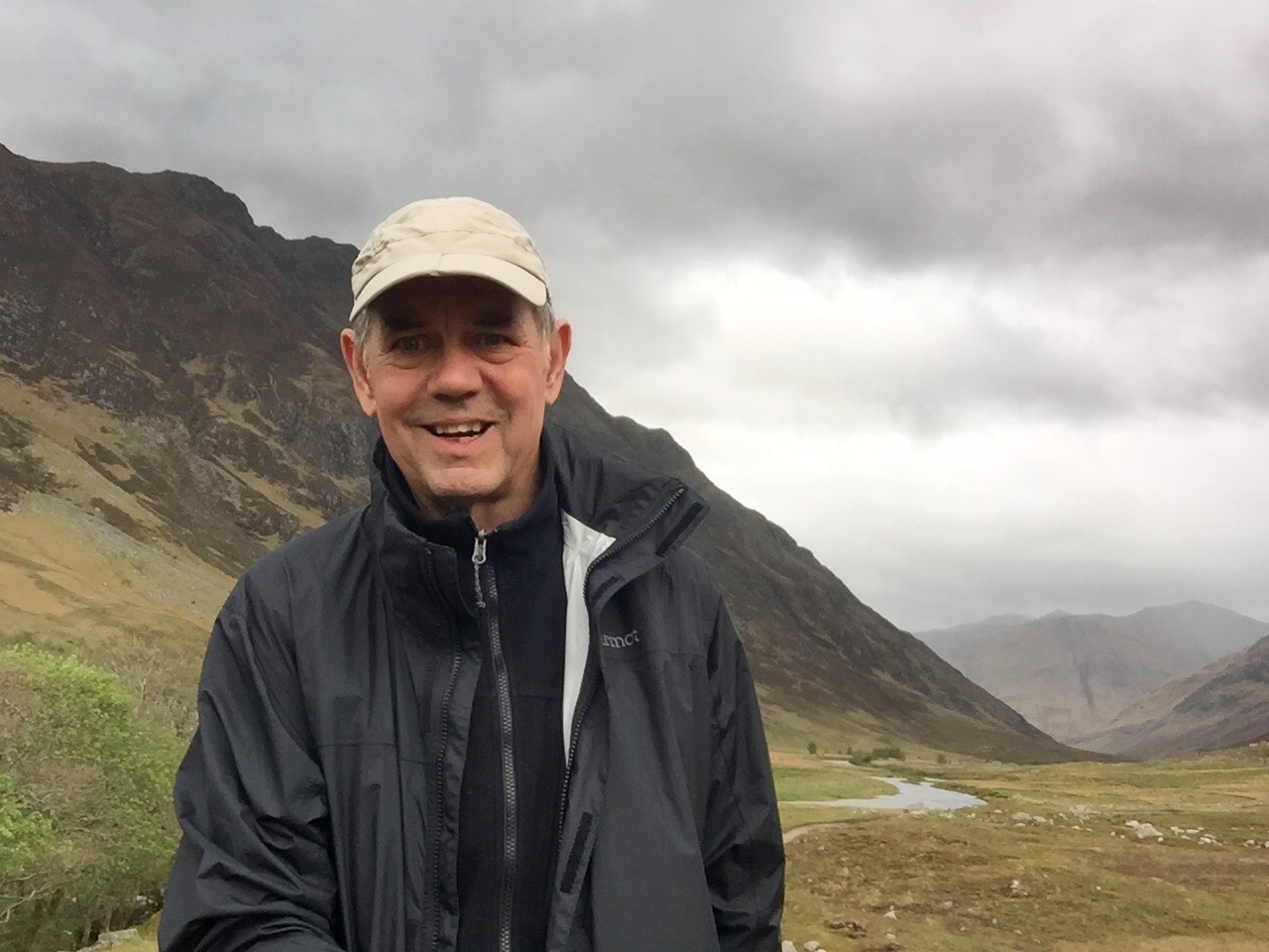
Colin Daniel, president of Apex Resource Management Solutions, has been an ecological consultant for more than 25 years. His work has focused on the development of tools and techniques to project landscape change, including projections of both vegetation and land use/land cover. Major clients include the U.S. Geological Survey, U.S. Forest Service, The Nature Conservancy, and LANDFIRE. Since founding ApexRMS in 2007, Colin has overseen the development of the company’s free ST-Sim software platform for developing spatially-explicit state-and-transition simulation models (STSMs) of landscape change, a LANDFIRE foundation. Colin says that the development and success of ST-Sim demonstrates the value and power of collaborations between government agencies, NGOs, and the private sector, and that "without that coordination, the ST-Sim and SyncroSim products would simply not exist today." Interview pdf. June 2019 Postcard.
Alan Ager's reputation as a research forester and planning analyst is well known. He joined the US Forest Service in 1987 as a planning analyst, and has spent the bulk of his career on landscape management issues related to fuels management and wildfire as part of Forest Service restoration and vegetation management programs. His recent focus has been on developing planning tools to simulate and explore national policy scenarios and predict investment outcomes in terms of economic and ecological conditions on national forests. Alan turned to LANDFIRE in 1994, when he learned how to use FlamMap to build realistic fire simulations for a study area in northeast Oregon. When combined with FlamMap, LANDFIRE's wall-to-wall fuels layers enabled Alan to simulate the ways fuel treatments changed burn probability and fire intensity. Read the interview pdf. May 2019 postcard.
"I love to learn almost as much as I love teaching," says Heather Heward, Senior Fire Instructor at the University of Idaho. "I am passionate about fire education and enjoy seeing the fire in my students as they learn about how they can make a difference in the broader world of fire ecology and management." She teaches most of the on-campus fire classes at the University of Idaho where LF data is used: the "Prescribed Burning Lab," "Fire and Fuel Modeling," and "GIS Applications in Fire Ecology and Management" courses. Heather's degrees from the University of Idaho are in Natural Resources Ecology and Conservation Biology with a minor in Fire Ecology and Management (B.S. 2006), and in Forestry, with an emphasis on remote observations of fires (M.S. 2009). Her fire career began in 2002. She worked eight seasons as a wildland firefighter in a variety of capacities.Read the interview pdf. November 2018 postcard.
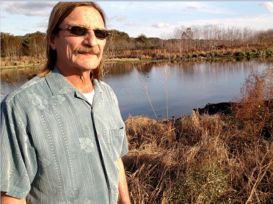
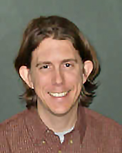
After receiving a B.S. degree in animal ecology from Iowa State University, Todd Hawbaker spent the next couple of years burning and restoring tallgrass prairie in southwestern Minnesota. He went on to receive both his M.S. and Ph.D. degrees in forestry from the University of Wisconsin before joining the U.S. Geological Survey as a research ecologist.
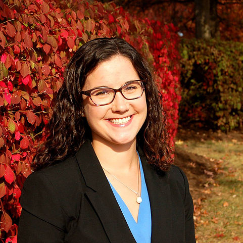
US Forest Service Fire Ecologist Christine Droske is working on a landscape-scale fire regime analysis that will provide the framework for management decisions on the Salmon-Challis National Forest. A key to revising the Forest’s Land Management Plan, the analysis will guide management direction for 4.2 million acres in north central Idaho, including 2 million acres within the River of No Return Wilderness. Christine has focused on leading project design and implementation on fuels treatment, prescribed fire, and forest restoration activities on the Salmon-Challis. She’s particularly excited about the project because it will enable managers to use wildfire as a tool for restoration and learn more about adapting to fire-dependent systems.Read the interview pdf. July 2018 postcard.
Addressing Wildfire Risk Across the Nation.
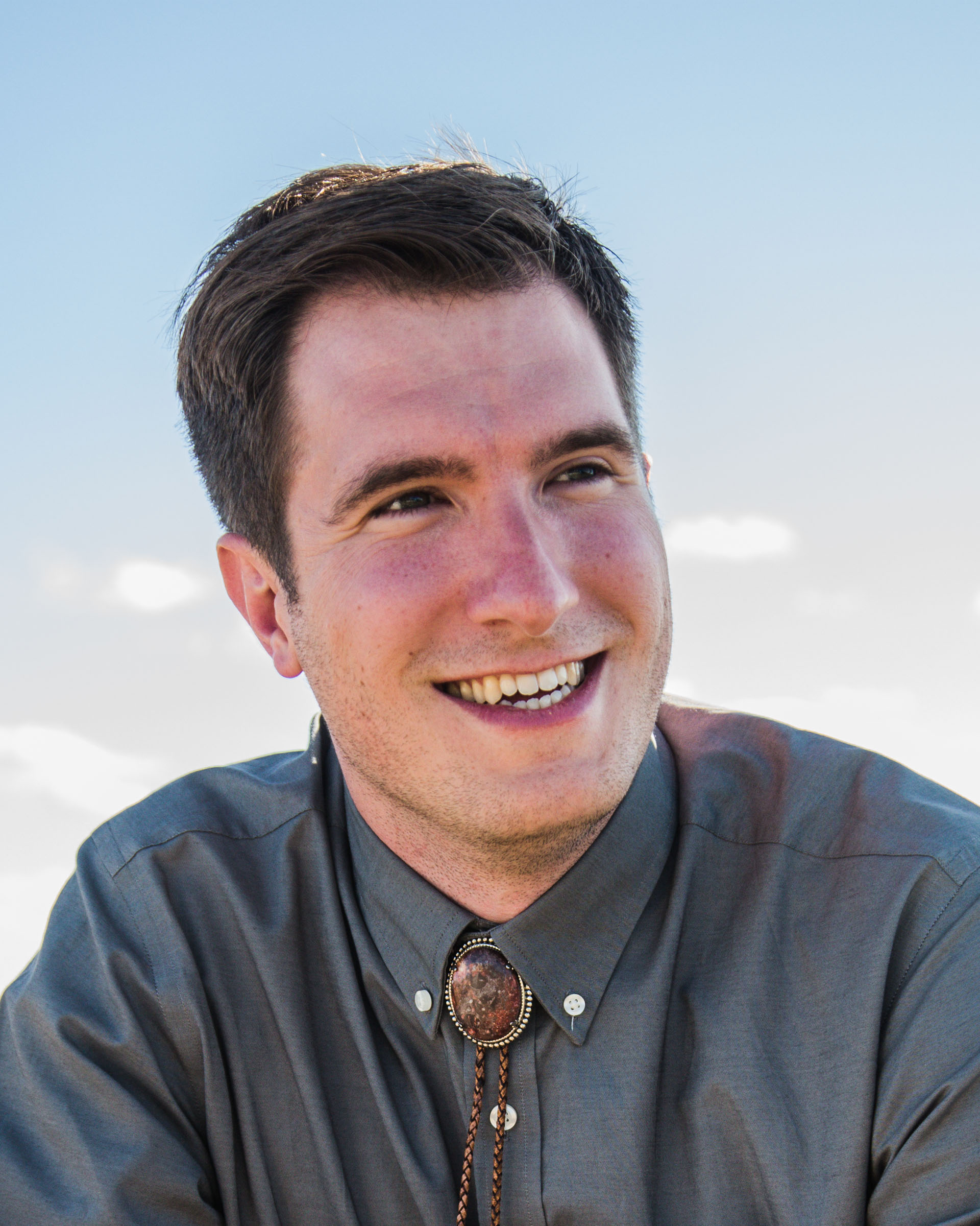
Greg Dillon, Forest Service spatial fire analyst with the Rocky Mountain Research Station’s Fire Modeling Institute (FMI), works on various projects that use geospatial technology to address land management and fire management questions. Two projects involve assessing wildfire risk across National Forest System lands in the United States. and producing and maintaining the Wildfire Hazard Potential map that depicts potential wildfire hazards across the U.S. Greg’s research centers around geospatial analysis, vegetation ecology, and fire ecology. In his current position with FMI, he applies recent advances in fire science and geospatial technology to address management questions from the national level down to local districts. In this interview, Greg talks about being with LF since the first day, including changes, improvements and best moments. Read the interview pdf. May 2018 postcard.
BLM Science and Research Needs from Rangeland to Climate Change.
Louisa Evers, Ph.D., has 30 years’ experience in fire and fuels management and fire ecology ranging from basic firefighter to fuels specialist and fire ecologist. She has worked across the western U.S. in both prescribed fire and wildfire response. In January 2012, Louisa became the science and climate change coordinator for the Bureau of Land Management (BLM) Oregon-Washington State Office. Louisa’s current focus centers on issues affecting greater sage-grouse habitat and sagebrush ecosystems, supporting the development of land use plans and their associated environmental impact statements, and providing a liaison with the research community in Oregon and Washington to support BLM’s science and research needs. Read the interview pdf. April 2018 postcard.
Vegetation Ecology Meets LF Data.
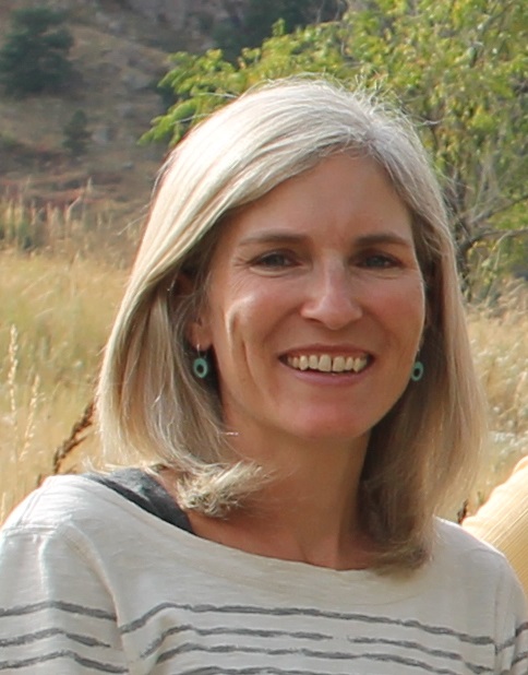
Vegetation ecologist Marion Reid is the NatureServe project manager overseeing a multi-year year effort to support the LF team in new mapping of the U.S. of ecological systems and National Vegetation Classification (NVC) Groups, and is contributing to the development of a Guidebook to the NVC for BLM. An "LF Lifer," she's collaborated with LF since the early 2000's on the first iterations of the auto-keys, and was involved in the first iterations of Biophysical Settings model development in the west. She's "been there, done that," so why is the LF Reference Database her favorite product? Read the interview pdf. March 2018 postcard.
Big Data, Big Applications
Dave Cleland, landscape ecologist with the USDA Forest Service, Forest and Range Management and Vegetation Ecology, Washington Office says that "LANDFIRE has the most consistent and I think best data available nationally on fire regimes, biophysical settings, and vegetative departures and dynamics." A LF "pioneer," Dave has held positions as a Forest Soil Scientist, Forest Ecologist, Research Liaison, Regional Ecologist, Research Ecologist, and Assistant National Vegetation Ecologist over the course of his career. Interview pdf. February 2018 postcard.
Supporting Users, Creating BpS Models
Fire Ecologist Kori Blankenship joined LF in 2004 as a GIS specialist at the Missoula Fire Sciences Lab, then moved to The Nature Conservancy's LF team in 2005. In her decade-plus at TNC, she has facilitated the creation of hundreds of vegetation models for ecosystems across the US. Her specialty is applying LF products to addressing land management challenges on large landscapes through data customization, user support, and outreach efforts. Interview pdf. January 2018 postcard.
Connecting Users and Mappers in Northeastern U.S.
Megan Sebasky, Northeast Region's (USFS Region 9) LF Coordinator, joined the Wisconsin DNR in March 2017 as Northeast's LF Coordinator - a new position supported by a State and Private Forestry grant to the Great Lakes Forest Fire Compact. Read the Interview pdf. Postcard November 2017.
Landscape-scale Analysis Essential to Success of Watershed Projects: Rio Grande Water Fund
Steve Bassett, Spatial Analyst and GIS Program Manager for The Nature Conservancy in Santa Fe, NM, works conservation projects ranging from optimizing investment in water source protection to measuring changes in aquatic habitats following the construction of dams. Interview pdf. Postcard October 2017.
LANDFIRE & GAP: Partnership Addresses Challenges of Land Cover Mapping
 Alexa McKerrow, ecologist and remote sensing analyst, joined the USGS National Gap Analysis Program in the 1990s. She leads a team of geographic information specialists on a variety of projects for the Core Science Analytics and Synthesis Program. On the Remap strategy team, Alexa works on updates to the methods and workflow for producing a new Existing Vegetation Type. Interview pdf. Postcard. August 2017.
Evaluating the US Forest Service Hazardous Fuels Treatment Program
 USFS Fire Ecologist Nicole Vaillant's interests include characterizing fire behavior at multiple scales, burn severity patterns, fuel treatment effectiveness, and wildfire risk analysis. She is involved with tech transfer and training for fuel management tools, e.g. ArcFuels and the Interagency Fuel Treatment Decision Support System (IFTDSS). Interview pdf. Postcard May 2017
Future Forest Dynamics Across the U.S.
Among Landscape Ecologist Jen Costanza's research interests are the ecological effects of global change, land change modeling and landscape conservation. She is working to produce future projections of forest conditions for the Forest Service’s Resources Planning Act Assessment.
Interview pdf.
Postcard January 2017
Quantifying Rangeland Fuels, Production, and Carbon
Research Ecologist Matt Reeves is with the USFS Human Dimensions Program, specializing in using remote sensing and GIS to evaluate issues facing U.S. rangelands. LF data are integral to the Rangeland Vegetation Simulator (RVS), a cutting-edge program for quantifying rangeland fuels, production, carbon and degradation. Interview pdf.July 2016.
Maps, Models, Metrics
Greg Low, founder/partner of Applied Conservation LLC provides consulting and facilitation services to public agencies, nonprofit conservation organizations, private landowners, and others. He specializes in forecasting, implementation, environmental dashboards, and organizational development in large landscapes, 50k-1m acres. Interview pdf. November 2016 postcard.
Remap: Creating a New LF Base Map
Josh Picotte is a fire specialist with ASRC Federal-InuTeq, Science Support Services Contract (SSSC) to the U.S. Geological Survey at the EROS Center in Sioux Falls, SD. As a member of the LF Remap Strategy Team, Josh is working to create a new base map data suite that represents contemporary conditions. Interview. March 2016
Restoring Fire in the Southeast
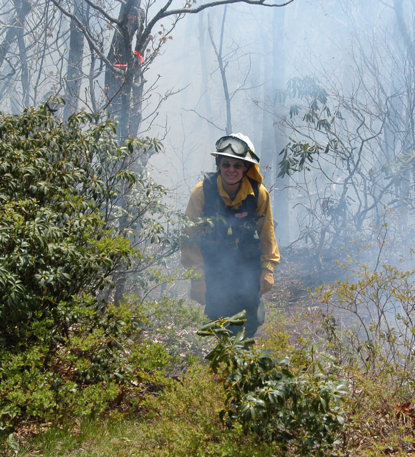
Fire Manager Margit Bucher of The Nature Conservancy, is a founder and current board member of the North Carolina Prescribed Fire Council, and co-lead for the Southern Blue Ridge Fire Learning Network. She oversees the fire management program on 50,000 acres of TNC lands in North Carolina. Disturbance ecology, understanding how ecosystems function, and the application of that knowledge to inform wildland management are her specialties. Margit is a burn boss and fire manager. Interview June 2016.
