Why LF Remap?
LF's original base map, LF National, was developed using Landsat imagery circa 2001. However, landscape change never ceases, and although LF National products were updated regularly throughout the years, the base map is more than 15 years old. To ensure the data remain relevant, LF has been developing the new base map product suite, LF Remap, to represent circa 2016 landscape conditions.
Process:
The LF program's consistent methodologies and processes incorporate current satellite imagery, user-community contributed data sets for the LF Reference Database and Events Geodatabase, contemporary data sources, and the latest software and hardware technologies to produce products that offer significant improvements to all previous versions. LF collaborated with Federal, State, tribal and other partners to develop products that support land and resource managers in project decision-making and inform local fire management decisions related to forests, rangelands, and other Federal and private lands.
More detail in this article: Picotte, J. et al. 2019. LANDFIRE Remap Prototype Mapping Effort: Developing a New Framework for Mapping Vegetation Classification, Change, and Structure. Fire 2019, 2:35. doi:10.3390/fire2020035.
Input data improvements:
-
New reference data - New and updated plot information is being compiled into a new
LF Reference Database (LFRDB), made possible by unprecedented access to new field datasets. The compilation significantly increases field data for non-forested areas and is used to inform existing vegetation mapping. The entire LF Remap Public LFRDB will be available for download at the completion of the Remap effort, expected in mid to late2020.
-
Image compositing - Nearly unlimited access to the Landsat archive along with improved preprocessing logic means more seasons of near cloud-free synthetic imagery instead of single scenes. The result is fewer seamlines and phenological differences, as well as better identification of vegetation type, cover, and height.
-
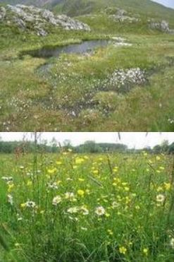
Masking – Masks of specific land cover types such as water (Integration of Landsat Essential Climate Variables, i.e. Dynamic Surface Water Extent), and barren/sparse that are important to fire behavior. This includes alpine or riparian/wetland classes that restrict where certain vegetation types can be identified.
-
Auto-Keying - Redesigned Auto-Keys to better determine existing vegetation type classification based on plot data in the LFRDB.
-
Disturbance– Integrating Landsat Essential Climate Variables, such as Burned Area to better inform the identification of disturbance on the landscape.
-
Lidar - Lidar data provides stronger linkages with vegetation structure allowing lifeform classifications to be improved.
Product improvements:
-
Vegetation structure - Better base imagery with fewer seamlines, created from a longer time horizon, combined with lidar data provides stronger linkages with vegetation structure so specific vegetation systems can be identified.
-
Vegetation Type – more and better plot data, more and better base imagery, masks of specific cover types like water and restricted ranges for certain type result in improved type identification.
New products:
-
Historical Disturbance - Uses the latest 10 years of disturbance data representing disturbance year and original disturbance code.
-
National Vegetation Classification - Allows opportunities to evaluate the vegetation classification and mapped products.
-
Fuel Vegetation Height, Cover, and Type - More accurately leverages fuel transition assignments related to disturbed areas by re-establishing pre-disturbance vegetation type, and binned cover and height products.
In addition to improvements to the Existing Vegetation Type (EVT), Existing Vegetation Cover (EVC), and Existing Vegetation Height (EVH) products, LF Remap has added a new product to the existing vegetation suite, National Vegetation Classification (NVC).
What is this? To better explain, “Group” level vegetation products tied to theNational Vegetation Classification Standard (NVCS) are now offered independently in addition to the Ecological Systems products LF has provided in the past. This NVC mapping work is the first national application of the standard with tangible, usable products.
Overview.
