 The High Allegheny Plateau Ecoregion (HAL) is located along the southern tier of New York and the northern tier of Pennsylvania. It includes a small portion of New Jersey. Well known features in HAL include the Catskills, The Shawangunks, The Kittatinny Ridge, The Poconos, Allegany State Park, Allegheny National Forest, and a large mass of Pennsylvania state-owned land.
The ecoregion is defined by high elevation features at the northern end of the Appalachian Plateau. Most of the ecoregion is above 1,200 feet. The general land form of the area is mid-elevation hills separated by numerous narrow stream-cut valleys.
One of the main features of the ecoregion is an abundance of rivers and streams. The Delaware, Susquehanna, and Allegheny Rivers and their many tributaries cover the entire ecoregion. The Delaware River drains into Delaware Bay; the Susquehanna flows into the Chesapeake Bay; the Allegheny flows into the Ohio and eventually into the Mississippi. These three different drainages contribute to the high overall aquatic diversity in the ecoregion.
The northern and eastern portions of the ecoregion were glaciated; the southwest portion was not. Many northern species and communities reach their southern limit in HAL, while many southern species extend into the ecoregion but not beyond. Species and communities associated with glaciated landforms occur in the north and east; biodiversity associated with older substrate and deeper erosional soils occurs in the southwest.
One of the main features of the ecoregion is its currently low population density, although major population centers are nearby. There are 1.7 million people living in the 16.9 million acres of HAL. The largest city is Binghamton, New York at 47,000. Only 250,000 people in HAL live in cities over 10,000. The overall population trend in HAL indicates that people are moving out of the ecoregion with the notable exception of the areas within reach of New York City by major highways.
There are large and significant managed areas in HAL, including three large intact forested areas: the Catskills, the Allegheny National Forest/Allegany State Park complex, and the Pennsylvania state land in central PA.
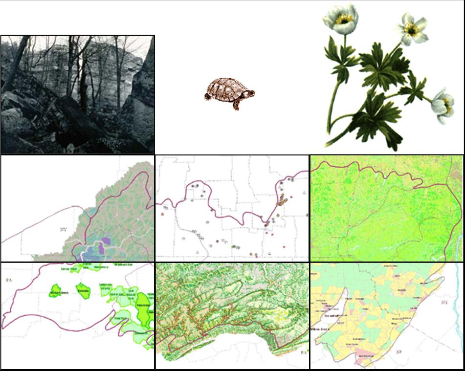
Maps
These maps will download as high quality pdf documents.
Full portfolio
Human population change
Landcover
Plant element occurrences
Animal element occurrences
Community element occurrences
Initial road-bounded blocks
Candidate matrix forest blocks
Ecological Land Units (ELUs)
Ecological land units and matrix blocks
Matrix blocks
Selected streams
Ecoregion overview
Targets
Glossary
Species
methods and
results of the planning and goal setting in this ecoregion. Communities
methods and
results can be downloaded as pdf documents. Download pdf reports for matrix forest
methods and
results. Finally, download aquatic
methods and
results. More detailed tables for all targets can be found in the
appendices section of this page.
Spatial data
Download all spatial data for the HAL ecoregion.
| Dataset name |
Definition |
|
Vector Data |
| aquaticexpertsites |
Sites chosen by aquatic ecology experts. |
| aquaticportfolio |
Portfolio of aquatic sites |
| blocks |
Road, utility line, railroad, and major hydrography line and polygon features used to build ecosystem blocks; chosen for impact on biodiversity. |
| censusblocks |
Housing unit density for the U.S. census block groups in 1960-1990 and estimates for 2000-2040. |
| cerclis |
Point sources of pollution: EPA Superfund data used in aquatic condition analysis. |
| counties |
Line and polygon boundaries for counties in Northeastern U.S. |
| dam |
National inventory of dams, used in aquatic condition analysis. |
| dws |
Drinking water supplies, used in aquatic condition analysis. |
| edu |
Ecological drainage units, used in freshwater analysis. |
| gnis |
Place names: an automated inventory of physical and cultural geographic features in the U.S.. |
| hucs8digit |
8-Digit Hydrologic Units for the Coterminous U.S. with TNC EDU attributes. |
| ifd |
Point sources of pollution: Industrial Facilities Discharge used in aquatic condition analysis. |
| matrix |
Viable matrix forest examples in the Chesapeake Bay Lowlands ecoregion. |
| managedareas |
Managed areas: All managed lands with a conservation purpose, along with other large state or federally managed lands greater than 500 acres. |
| mines |
Point locations of all mines in the ecoregion. |
| pcs |
Point sources of pollution: Permit Compliance System used in aquatic condition analysis. |
| roads |
Roads in the ecoregion. |
| shed2-conditionsum |
Condition of the local watersheds for each RF3 reach in the sequenced flow network for the HAL ecoregion. |
| shedsize1 |
Local watersheds for size 1 rivers. |
| shedsize2 |
Local watersheds for size 2 rivers. |
| size1-reachcondtop |
Size 1 stream reaches in the top condition. |
| streams |
EPA 1:100000 RF3 reaches within the TNC Chesapeake Bay Ecoregional Stream System Type 10 group. |
| tri |
Point sources of pollution: Toxic Release Inventory; Water release in 1995 used in aquatic condition analysis. |
|
Raster Data |
| dem20zip |
30 meter Digital Elevation Model: National Elevation Dataset processed to fill cell depressions or sinks that reflect isolated surface error. |
| elu30zip |
Ecological Land Units: Grid of 30 meter cells that combine the Quaternary geology of the Chesapeake Bay Lowlands and the region's landforms. |
| nlcd |
National Land Cover Dataset of the USGS and EPA for the CBY ecoregion. |
Appendices
Terrestrial tables:
Working with targets in the occurrence table (Download instructions)
List of Element Occurrences in HAL (Download xls)
Species by ecoregional subsection (Download xls)
Review of community portfolio in relation to goals
(Download xls)
Element Occurrences by matrix block (Download xls)
Matrix block summary statistics (Download xls)
Background information about ELUs (Download doc)
Expert interviews about species distributions (Download .doc)
Metadata for experts interviews document (Download .doc)
Access database of expert interviews (Download)
All matrix block reports (Download pdf)
Aquatics tables:
Size 2 stream watershed condition statistics (Download xls)
Aquatic element targets (Download xls)
HAL fish distribution (Download xls)
Ecological Drainage Units (Download xls)
Aquatic selected sites (Download xls)
Aquatic condition analysis metadata (Download .doc)
Powerpoint presentation of aquatics maps (Download ppt)
